
|
|
|
Maps of Grindley Brook
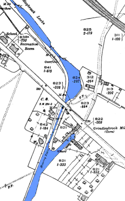
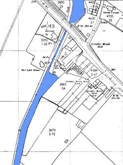
In the map on the left made in 1900 the arm that ran down the south side of the Grindley Brook mill is clearly seen. This would have been the limit of navigation to the north until the link with the Shropshire canal at Nantwich was completed in 1805 The map on the right from 1963 shows the canal as we see it today with the arm filled in. |
||||||||||||||||||||||||||||||||||||